Your Location Is Showing: The Rise of Spatial Intelligence and What Every American Needs to Know
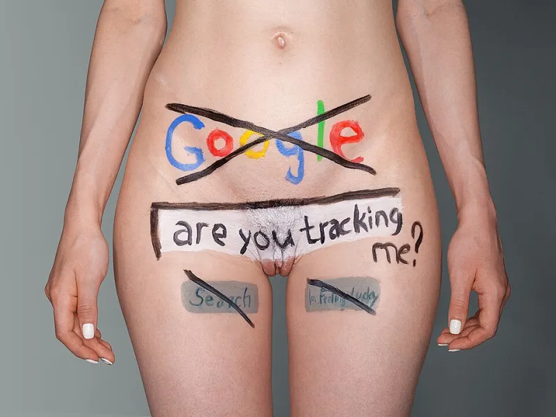
Photo: Exey Panteleev from Moscow, Russia, CC BY 2.0, via Wikimedia Commons
There is a question worth sitting with for a moment: When did you last make a decision without consulting a map? Not a paper map—those have become curiosities—but a digital one. The navigation app that routed you around this morning's highway backup. The delivery tracker that showed a package moving toward your door. The restaurant finder that sorted options by proximity. Location is woven so deeply into the fabric of American digital life that its presence has become invisible. And that invisibility carries consequences worth examining.
The Quiet Infrastructure of Where
Geospatial data—information tied to specific locations on Earth—is generated in volumes that strain comprehension. Every smartphone ping to a cell tower, every GPS-enabled transaction, every satellite image captured over American soil contributes to an ever-expanding archive of locational information. Analysts at the geospatial intelligence firm Maxar have estimated that commercial satellite constellations now image most of the Earth's surface multiple times per day. The resolution of that imagery, once the exclusive province of military reconnaissance, is now commercially available to any organization willing to pay for it.
This is not merely a technological curiosity. It is the foundation of an industry. Location intelligence—the practice of deriving actionable insight from spatial data—has become a significant economic sector in its own right, with the global market valued at tens of billions of dollars and growing steadily. American companies, from retail chains to insurance carriers to political campaigns, are investing heavily in geospatial analytics capabilities. The question is not whether location data is shaping decisions that affect your life. It is how, and to what degree you are aware of it.
Retail Site Selection: The Geography of Commerce
Consider the seemingly mundane question of where a new coffee shop or pharmacy opens. To the casual observer, these decisions may appear driven by intuition or local knowledge. In reality, the site selection processes of major American retail chains have become exercises in applied spatial analytics.
Retailers routinely use GIS platforms to analyze trade area demographics, competitor proximity, traffic flow patterns, and co-tenancy relationships—the documented tendency of certain business types to perform better when located near complementary retailers. Starbucks, Target, and Walgreens each maintain sophisticated internal geospatial analytics teams. Smaller chains and franchisors increasingly access similar capabilities through specialized vendors like Esri's Business Analyst platform or CARTO's retail analytics tools.
The implications extend beyond corporate strategy. When location intelligence guides where grocery stores open—or, crucially, where they do not—it shapes the nutritional environment of entire communities. Food deserts in American cities are not random geographic accidents. They are, in part, the product of site selection analyses that have systematically underweighted the purchasing power of lower-income neighborhoods. Understanding that these decisions have a spatial logic, and that the logic can be examined and challenged, is a form of civic empowerment.
Climate Risk, Insurance, and the Redrawing of the American Map
One of the most consequential applications of location intelligence in contemporary America involves the assessment and pricing of climate-related risk. Insurance companies have long used geographic data to inform underwriting decisions—flood zone designations, wildfire hazard scores, and hurricane exposure models have influenced homeowners' insurance premiums for decades. What has changed is the sophistication and granularity of that analysis.
Today, insurers and reinsurers employ proprietary catastrophe models that assess risk at the individual parcel level, incorporating satellite-derived vegetation data, LiDAR-based terrain analysis, and historical claims records geocoded to specific addresses. The results are reshaping the insurance landscape in ways that are already affecting millions of American homeowners.
In California, Florida, and Louisiana, major insurers have withdrawn from markets or dramatically increased premiums in areas identified as high-risk by these spatial models. Homeowners in affected areas often have limited visibility into the specific geographic factors driving their coverage decisions. The data underlying those decisions—derived from sophisticated GIS analysis—is proprietary. This asymmetry of spatial knowledge between institutions and individuals is a defining feature of the current moment.
Policy, Power, and the Politics of Place
Location intelligence is not confined to the private sector. Government agencies at every level use geospatial analysis to inform decisions that carry significant implications for equity and justice. Redistricting—the decennial process of redrawing legislative boundaries—is perhaps the most politically charged application of spatial data in American civic life. Modern redistricting software allows mapmakers to optimize district boundaries with a precision that earlier generations of political operators could only imagine, raising serious questions about the relationship between geographic analysis and democratic accountability.
Public health agencies use spatial analysis to track disease transmission, identify vaccination deserts, and allocate resources across populations. The COVID-19 pandemic provided a vivid demonstration of how geographic data could accelerate public health response—and how disparities in data quality across different communities could compromise that response.
Environmental justice advocates have long argued that industrial facilities, waste sites, and other pollution sources are disproportionately located in communities of color and low-income neighborhoods. GIS-based cumulative impact analysis tools, including California's CalEnviroScreen and the federal Environmental Protection Agency's EJScreen platform, have given advocates and regulators a shared spatial vocabulary for documenting and addressing these disparities. Geographic literacy, in this context, is not a technical nicety—it is a tool of accountability.
The Privacy Dimension of Location Data
Any honest accounting of location intelligence must grapple with its privacy implications. The same data streams that enable sophisticated retail analytics and climate risk modeling also enable surveillance at a scale that raises serious civil liberties concerns. Location data derived from smartphone apps has been used to track the movements of individuals attending political protests, visiting medical facilities, and crossing international borders—all without their explicit knowledge or consent.
The legal framework governing location data in the United States remains fragmented and inadequate relative to the technology's capabilities. While the Supreme Court's 2018 decision in Carpenter v. United States established that law enforcement generally requires a warrant to access historical cell-site location data, significant gaps remain. Data brokers operate in a largely unregulated space, aggregating and selling location datasets derived from apps whose privacy disclosures few users read carefully.
Geographic literacy, in this context, means understanding not only how location data is used to analyze the world, but how it is used to analyze you. Knowing that your phone generates a continuous stream of locational information, that this information can be purchased and analyzed by parties whose interests may not align with yours, and that the geographic patterns of your daily life can reveal sensitive information about your health, beliefs, and relationships—this knowledge is a prerequisite for informed consent in the digital age.
The Case for a Spatially Literate Public
Digital literacy has, rightly, become a priority in American education and public discourse. The ability to evaluate online information critically, understand how algorithms shape content exposure, and navigate digital privacy settings is increasingly recognized as a foundational civic competency. The argument here is that geographic literacy deserves comparable recognition.
Maps are not neutral documents. They reflect choices about what to show, what to omit, how to aggregate data, and how to define boundaries. A choropleth map of COVID-19 mortality rates can tell dramatically different stories depending on whether it uses raw case counts or rates per capita, and whether its color scale is linear or logarithmic. A flood risk map that uses the 100-year floodplain as its boundary communicates something meaningfully different from one that shows the 500-year floodplain—yet both are accurate.
Citizens who can read maps critically, who understand the basics of how spatial data is collected and analyzed, and who recognize the ways that location intelligence shapes decisions affecting their communities are better equipped to participate in democratic life. They are more capable of holding institutions accountable for the spatial choices those institutions make.
The geography of American life—where opportunity concentrates, where risk accumulates, where investment flows and where it does not—is not fixed. It is the product of decisions, many of them made with sophisticated spatial tools that most Americans have never encountered. Closing that gap in awareness is, at its core, a question of equity. Location intelligence is too consequential to remain the exclusive domain of specialists.