Beneath the Surface: How Spatial Data Is Transforming the Management of America's Underground Utility Systems
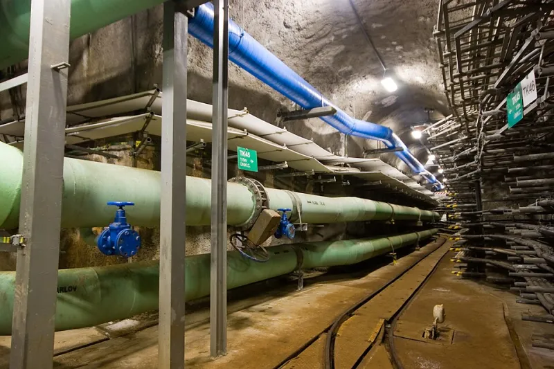
Photo: Honza Groh (Jagro), CC BY-SA 3.0, via Wikimedia Commons
America's cities run on infrastructure most residents never see. Buried beneath sidewalks, roadways, and front yards lies an intricate labyrinth of water mains, natural gas pipelines, electrical conduits, and fiber-optic cables—a subterranean architecture that silently sustains daily life. When any part of this network fails, the consequences can range from inconvenient service outages to catastrophic explosions and flooding. For decades, managing these systems meant relying on paper records, institutional memory, and a degree of educated guesswork. That era is ending.
Geographic information systems are fundamentally changing how utility operators and municipal engineers understand what lies beneath their feet. By layering spatial data across a unified digital environment, GIS platforms are converting fragmented, often outdated records into living, queryable maps that can guide everything from routine maintenance to emergency response.
A Legacy of Paper and Guesswork
The challenge of managing underground infrastructure in the United States is, in large part, a historical one. Many of the nation's utility networks were installed over the course of a century or more, documented inconsistently across different eras of record-keeping. Water systems in older northeastern cities may include cast-iron mains installed before World War I. Telecommunications conduits in urban cores can predate digital records entirely.
The result is a patchwork of knowledge that has long frustrated engineers and safety officials alike. When a contractor strikes a gas line during excavation—an event that occurs thousands of times annually across the country—it is frequently because the available records were imprecise, incomplete, or simply wrong. The American Society of Civil Engineers has consistently graded the nation's water infrastructure a D-plus in its infrastructure report cards, citing aging systems and deferred maintenance as primary concerns.
GIS technology does not eliminate aging pipes, but it provides the foundational layer of spatial awareness that makes systematic improvement possible.
Building the Digital Underground
Modern utility GIS programs begin with a data-collection phase that can itself be a substantial undertaking. Municipalities and utility companies deploy a range of technologies to locate and verify buried assets: ground-penetrating radar, electromagnetic locating equipment, and acoustic sensors capable of detecting the pressure signatures of water leaks. Field crews equipped with GPS-enabled tablets record the precise location, depth, material type, and installation date of each asset they encounter.
This information is then imported into a GIS platform—commonly Esri's ArcGIS Utility Network or an open-source alternative such as QGIS—where it is assigned geographic coordinates and linked to attribute tables containing maintenance histories, inspection records, and condition assessments. The result is a spatial database that can be queried in ways no paper map ever could.
A water utility, for instance, can run a spatial analysis to identify all mains installed before 1960 that cross beneath high-traffic roadways—a query that might take a team of engineers weeks to answer using legacy records but can be resolved in seconds through a GIS interface. That kind of insight directly informs capital improvement planning and helps utilities prioritize limited maintenance budgets.
Reducing Disruptions, Preventing Disasters
The operational benefits of utility GIS extend well beyond planning. Real-time integration between GIS platforms and supervisory control and data acquisition (SCADA) systems allows operators to overlay live sensor data—water pressure readings, gas flow rates, electrical load measurements—onto their spatial maps. When an anomaly appears, operators can immediately visualize which segments of the network are affected and identify the valves or switching points needed to isolate the problem.
In Chicago, the Department of Water Management has used GIS-driven predictive modeling to identify water mains at elevated risk of failure before they rupture, reducing the number of costly emergency repairs and the street-level disruptions that accompany them. Similar programs are underway in cities including Phoenix, Denver, and Atlanta, where aging distribution infrastructure intersects with rapid population growth.
For natural gas utilities, the stakes are even higher. Following a catastrophic pipeline explosion in San Bruno, California in 2010—an incident that killed eight people and destroyed dozens of homes—federal regulators accelerated requirements for gas distribution companies to verify and spatially document their pipeline records. The National Pipeline Mapping System, maintained by the Pipeline and Hazardous Materials Safety Administration, now draws on GIS submissions from operators across the country to provide a federal-level view of gas transmission infrastructure.
The Interoperability Imperative
One of the persistent challenges in utility GIS is the fragmentation of data across agencies and organizations. In a typical metropolitan area, water service may be managed by a municipal department, gas distribution by a private utility, electrical transmission by a regional grid operator, and telecommunications by multiple competing providers. Each entity may maintain its own GIS environment, with different coordinate systems, attribute schemas, and data standards.
Efforts to bridge this fragmentation are gaining momentum. The Common Ground Alliance, a nonprofit organization focused on damage prevention, has championed data-sharing standards that allow utilities to exchange spatial information more effectively. Several states have enacted legislation requiring utilities to submit digital records to centralized repositories, making it easier for excavation contractors to access accurate location data before breaking ground.
Open data initiatives at the municipal level are also contributing to greater transparency. Cities including New York and San Francisco have published portions of their utility GIS data through public-facing portals, allowing researchers, urban planners, and community advocates to incorporate infrastructure information into their own spatial analyses.
The Path Forward
The integration of GIS into utility management is not a finished project—it is an ongoing process of data refinement, technological adoption, and organizational change. Many smaller municipalities and rural utilities still operate with minimal spatial data infrastructure, facing the dual challenge of limited budgets and a workforce that may lack GIS expertise.
Federal investment through the Infrastructure Investment and Jobs Act of 2021 has directed significant funding toward water system improvements, and several grant programs explicitly support digital modernization efforts, including GIS implementation. Organizations such as the Water Research Foundation and the American Water Works Association have published technical guidance to help utilities of all sizes develop spatial data programs.
What is becoming increasingly clear is that the invisible networks beneath American streets cannot be managed effectively without a clear spatial picture of where they are, what condition they are in, and how they interact with one another. GIS technology is providing that picture—one mapped layer at a time—and in doing so, it is helping to ensure that the infrastructure Americans depend on continues to function, even when they never have to think about it.